INTRODUCTION:
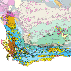
This website provides several groundwater-related maps from projects done for various organisations, mainly focusing on South Africa. The maps were produced with only open-source software: the QGIS desktop Geographic Information System for the setup of the mapping projects, which are then served with QGIS Server to the Lizmap web client for display in a browser. The groundwater and layer data is stored in PostgreSQL databases. The groundwater database is constantly being updated with the Aquabase Water Resources Management Software, providing a "live" map in the browser: as soon as data is changed or added it will show on the map!
Please note: Depending on the complexity of the maps they may take a while to load, as some of them have quite a large number of different layers. Once loaded the navigation of the maps is pretty fast. Please refer to the "View Metadata" links for each project to obtain more information on the project and how to use the map.
DISCLAIMER / TERMS OF USE (the fine-print):
This mapping website and its data displayed should be used with caution! It is not intended to be used for groundwater management purposes, for which an in-depth groundwater study may be required. Some of the data from the database may be quite old and may not necessarily represent current conditions. Any links to other online resources and the information displayed from them are the responsibility of the relevant web page creators/maintainers/owners.
Although the data displayed on this web site has been produced and processed from sources believed to be reliable, no warranty, expressed or implied, is made regarding accuracy, adequacy, completeness, legality, reliability or usefulness of any information. This disclaimer applies to both isolated and aggregate uses of the information. The information is provided on an "as is" basis. All warranties of any kind, express or implied, including but not limited to the implied warranties of merchantability, fitness for a particular purpose, freedom from contamination by computer viruses and non-infringement of proprietary rights are disclaimed. Any action you take upon the information on this website is strictly at your own risk and we will not be liable for any losses and damages in connection with the use of our website and data displayed.
Changes may be periodically made to the information herein; these changes may or may not be incorporated in any new version of the map publication. If you have obtained information from the owners of this website from a source other than the owner’s web site, be aware that electronic data can be altered subsequent to original distribution. Data can also quickly become out-of-date. It is recommended that careful attention be paid to the contents of any data associated with a file, and that the originator of the data or information be contacted with any questions regarding appropriate use. If you find any errors or omissions, please report them to immo[AT]blecher.co.za.
AVAILABLE PROJECTS:
Below are a number of mapping projects that are publicly accessible. There are a number of additional projects for which a login is required to access their maps, e.g.
- Groundwater database for the Western Cape Government - Water Business Continuity Project
NOTE: If you are looking for the Table Mountain Water Source Area Dashboards project then you will have to visit the project's new website location . If you are looking for the Kropz Elandsfontein Groundwater Monitoring project you will have to go to the project's new website at https://elandsfontein.groundwaterinfo.africa . You may have to register again for access to these, if required.
You may register for map access by clicking the top right "Register" button, where you will be able to supply a reason for you to be allowed access to these maps. Please specify the map or maps for which you would like access as this needs to be approved by the website administrator. Once approved you will be able to see the relevant maps on this "Projects" page, after clicking the "Connect" button and supplying username and password as per registration. In order to register or log in you can also click one of the links below:

